Scaling up a Elementary Block to Fit a Middle School Geography Curriculum
We recently did a block for geography that I used a lot of the books and activities that we did in elementary school. This was a short three-week block. For this post, I’m going to show you how I scaled the entire block up to fit a middle school child. If you would like to see more about or purchase my Maps Study Guide; it’s in my shop.

Map Unit Study Curriculum
This curriculum is a 12-lesson unit study introducing the beautiful world of Maps.
In this post you’ll find:
The first thing that we did was to shift some of the books. We used many of the books in our earlier block, but added more books that were age appropriate. Mapping a Changing World was read aloud, but much of the other books were independent reading. We would then discuss the material read the following day. Some of the material was used for a main lesson page, but much of it was not. Our book list follows. All the images are hyperlinked.
Video of Books
Books
Images are hyperlinked
Spines


Source Books for Activities


Other Books


Games and Activities
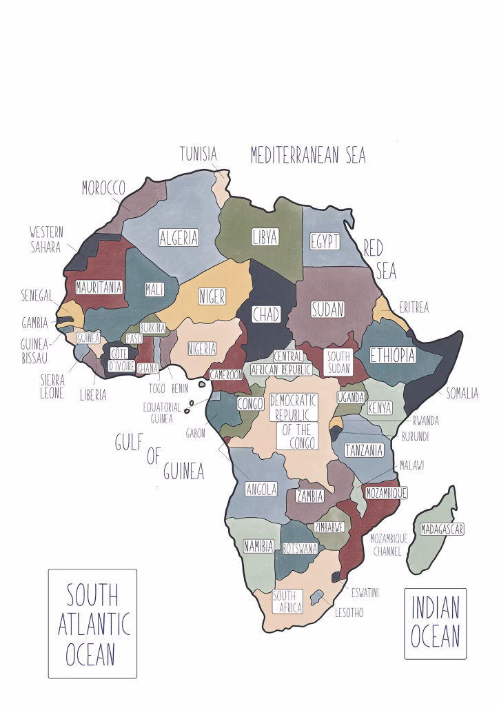
One goal of our geography for me is that we have a familiarity of the different parts of the world. To help do this, one aspect of our opening activities during this block (and beyond,) we did a couple of geography games. One of those game is to take a quick study of a map of a contentment for a few minutes, and then after those few minutes, put the map away and fill in as much as we can remember of a blank map. Eventually we would be able to fill out much, if not all, of the map by memory. It’s fun, short, and has little as far as stakes. The only “grading” that is done is to compare how many we were able to do ourselves prior compared to the present one to see how much progress we are making.
Geography Map Memory Game
The second game that we used is Flags of the World. This is a card deck with flags from all over the world. We separated them by continent which the cards are color-coded for, and worked on a continent at a time. First we would just look at, read the trivia information on the cards, and perhaps come up with ways to help us remember. This memory work is from our Study Skills block we did previous to the year. Then we would lay four cards down at a time and take turns picking the ones that we knew, then checking ourselves. It’s a fun light way to become familiar with the flags of all the countries.
Though we didn’t use it this time around, I think that Ms. Wood Cork map would be a fabulous activity to go along with these. We have the map pins that we are able to place on the country of the cork map.
Other Games and Resources


Scaling up the Activities
We did several of the activities that we did before in the elementary years again in the middle school block. However, most of these were scaled up to fit the level of skill for this age group. For the compass rose design, in place of just coloring in a sheet that had a compass rose, we designed the compass rose ourselves using the division of circle work. We used what we had learned from our geometry – bisection of a line through a dot on that line, drawing a line perpendicular to a line, and bisecting an angle – to divide the circle into 16 parts and construct a compass rose design from the division.

We repeated making a map with a legend for our main lesson books. This time around our maps were more complex and integrate. They were also done independently.

For the activity of mountains around the world to scale, we researched the tallest mountains in each of the continents. We then used this range of measurements to draw to scale the mountains on our page of paper. We used the ratio of our paper which was 9 inches tall to the tallest mountain, Mt. Everest. We divided the height of Mt Everest by the 9 inches to see how much 1 inch represented in feet. Here we went about calculating the inches we would need for each of the other mountains by dividing each mountain’s measurement by the scale to see how many inches it would be from the bottom.
Once we had the heights of our mountains for the paper, we then practiced drawing mountain ranges in general with chalk pastels. When we felt we could draw them to our satisfaction, we used the mathematical measurements that we had to draw each of the mountains to range on our main lesson page.

Another activity that we scaled up was the topography activity found at the end of the Map Study Guide. In the guide, the topo map is provided to print and translate into a 3-D project of cardboard. For this activity, we used a far more complex topography map. This map was significance to my family as it is an area of the Great Smokey Mountains that we hike often when we travel back home to visit family. Instead of just a few topography contour lines being used, this one had quite a few layers. The project was also done independent of my help. This allowed her to get a better idea of how a topography map expresses elevation.

We also added in a few other art activities. One worth mentioning was a layered tissue and yarn art activity from the book Map Labs. We started by creating our background with layered tissue paper over a crinkled plastic bag. When those layers were glued and painted, we added our latitude and longitude lines. Of course, I used this opportunity to use recall the information as much as possible from our memories, and then go over any information we missed. These lines were created using yarn. We placed a few more layers onto our block for the background. When it was completely dry, we added our island or land mass to be charted onto our background.

Picture Study
For this block, we did two kinds of picture study. The first was to study and discuss the map at the beginning of each chapter of the book Mapping a Changing World. This books go through almost a short history of maps, what their function was (hint: it’s not always navigation). We took a time to do a picture study similar to a Charlotte Mason-style artist picture study. We would spend a few minutes talking about the colors used, the information that we saw, how the map was arranged, which direction the map was oriented. This would happen before we read the chapter which often discussed the maps and similar maps of that time period and region.
We also did three other Charlotte Mason-style picture study using the different artist that the book Map Labs presented. We didn’t always do the accompany activity, but we would spend a little time examining and evaluating a piece of art from the artist that was featured after reading a bit about them.
Main Lesson Pages
This block included several main lesson pages. Most of the main lesson pages, aside from the activity pages were accompanied by a narration composed by my daughter or on her independent reading. There was one on each of the five inhabited continents, one on how maps work generally, and one for each of the mapping activity that we did (potato contour lines, the compass rose, the latitude and longitude map art activity.)
Just a note: I participate in Affiliates Programs. When you use some of the links above, your cost is the same, but I receive a very small commission from your purchase. For more information on my relationships see my Policies and Disclosures page.